The map
A 3D map of your place
Terrain, sun, water and your sites, ready to drop into the website you already have.
- Every view on this page
- Embeds with one line
- Works on phones
Sample place: illustrative plan on real terrain
Twin Lakes · Lake County, Colorado · 9,206 ft
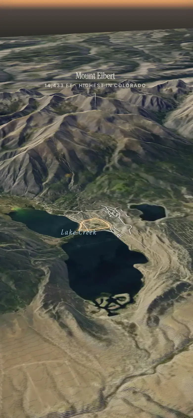
Mount Elbert stands 5.0 miles off and 5,227 ft higher, yet this lakeside bench keeps the winter sun until 3:50 pm. One sample place, read from public data, then planned for homes and a lodge.
I The land
125 acres on a glacial bench above Twin Lakes, at 9,189 to 9,296 ft. Six questions every buyer asks, each answered from free public data with its source and date.
I The land · 1 of 6 · Terrain
USGS lidar puts the bench at 9,206 ft. Mount Elbert, Colorado's highest summit at 14,433 ft in the same elevation data, fills the view to the west-northwest. The shore end sits 107 ft below the high corner of the outline.
I The land · 2 of 6 · Slope
Only 8% is steeper than 25%, mostly the old moraine ridges along the shore. Green is easy ground, amber needs some grading, rose is for trails and views.
I The land · 3 of 6 · Water
15.9 acres around the ponds are mapped wetland (USFWS), so the plan leaves them open. Blue lines are where water would run after a storm, computed from the lidar. FEMA's map shows no mapped flood zone on the outline (panel 08015C0075D, effective Dec 7, 2017).
Not a flood determination. A lender or insurer uses FEMA's official map and an elevation certificate.
I The land · 4 of 6 · Sun
Shadows here are traced across the real terrain, 9 miles out. Drag the time and watch them move.
Direct sun 7:30 am to 3:50 pm · 8.4 h of a possible 9.4 h
I The land · 5 of 6 · Ground
The county soil survey calls most of it "Mined land": reworked ground it does not rate. The native soils around it drain fast and are full of stones, so the survey rates them very limited for a standard septic field.
What this means: plan on a geotechnical check before foundations and an engineered septic system or a sewer tap. A soil test on site decides.
I The land · 6 of 6 · Spots
Gold marks ground that is gentle, dry and sunny all at once. It's a public-data screen to guide a site visit, not a finding.
II Homes · Sample plan
We drew a sample lot plan on the gentle ground only, clear of the ponds, the wetland and the shore. Every lot is scored from the lidar: slope, December sun at the house spot, and what you'd see from a second-floor window.
Sample plan for this demo: lot lines are illustrative, not a plat. Access, utilities and zoning are not designed here.
II Homes · Pick a lot
View: share of 90 sample points on the lake visible from 5 m up at the house spot. Sun: Dec 21, terrain shading only (trees not included).
III A place to visit · Sample lodge
On the point above the narrows we placed a sample lodge, a ceremony lawn and 5 cabins. On a June Saturday the ridge across the lake takes the sun off the lawn at 7:32 pm, about an hour before sunset. The page does the math for every date.
III Visit · Plan a date
The ridge across the lake hides the sun 62 minutes before sunset.
5 sample cabin sites on the open ground by the shore, placed where the lake view is widest.
Real trails from the US Forest Service, measured from the lodge.
IV Yours
We build this for real places: land for sale, new homesites, venues, lodges, campgrounds. Your terrain, your water, your sun, told so a buyer or a guest gets it in five seconds.
The map
Terrain, sun, water and your sites, ready to drop into the website you already have.
The website
A cinematic one-page site for your place: your story, photos, inquiries or booking.
Both Like this page
Everything on this page, built around your place instead of ours.
Tell us where it is and what you sell. We reply with a quick look at your ground from public data.
What this page is built from
| Terrain | USGS 3DEP 1 m lidar DEM (CO_SanLuisJuanMiguel_2020_D20, CO_WestCentral_2019_A19, UT_COUTAML_D24; published 2026-06-30); 10 m 3DEP and AWS Terrain Tiles for the far mountains |
|---|---|
| Aerial | USDA NAIP, Sep 22, 2019 (0.6 m), via USGS The National Map |
| Flood | FEMA National Flood Hazard Layer, checked 2026-10-29; panel 08015C0075D, effective Dec 7, 2017 |
| Wetlands, creeks | USFWS National Wetlands Inventory; USGS National Hydrography Dataset |
| Soils | USDA NRCS SSURGO CO658 Chaffee-Lake Area, Colorado, Parts of Chaffee and Lake Counties (SSURGO, updated 9/2/2026) |
| Trails, roads | USDA Forest Service trails (EDW), checked 2026-10-29; US Census TIGER roads |
| Sun | SunCalc and our own terrain shading (9 mi rays, 2 min steps); trees and buildings not included |
| The plan | Outline, lots, lodge, lawn and cabins are illustrative, drawn by us for this sample. No real owner, listing or business. |
Terrain: USGS 3DEP lidar · Aerial: USDA NAIP Sep 22, 2019
For planning only. Not a survey or engineering report.