1 of 6
The whole place, in 3D
Hills, fields, woods and water, from real aerial photos and elevation. Anyone can turn it with a finger, on their phone, from anywhere.
Websites + 3D maps
For land, homes and new communities, venues, campgrounds, resorts and farms. Customers explore your place on their phone before they ever drive out. You see a working draft before you pay.
01The 3D map
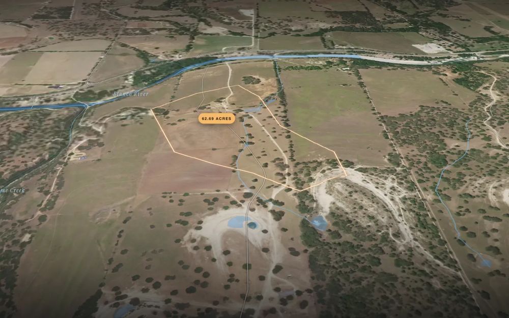
This is a sample: real farmland in Wisconsin, built from public data. Scroll, and it shows what a 3D map tells your customers.
1 of 6
Hills, fields, woods and water, from real aerial photos and elevation. Anyone can turn it with a finger, on their phone, from anywhere.
2 of 6
Good for a house site, a row of tents, a ceremony lawn or a new street. The faint lines are 20 ft contours.
3 of 6
The blue lines show where rain runs and gathers. On a real property we can add the FEMA flood zone, with its date and a link to the source.
4 of 6
Keep scrolling and the sun crosses the sky, with shadows from the real hills. Golden hour on the lawn, shade at the campsite, which lot gets winter sun.
6:00 AM
5 of 6
Homesites, campsites, the photo spot, the trailhead. You tell us what to mark, and the map can also point out gentle, high, dry ground worth a closer look.
6 of 6
Each map ends with the questions your customers always ask, in plain words.
Fewer "where exactly is it?" calls. More people who show up ready.
02What we make
Pick what fits. Already happy with your website? Add the map to it. Need a new site but not a map? That's fine too.
Map only
A 3D map of your place for the website you already have, or a page of its own to share for a listing or a sale.
from $499 + $49/mo
Website only
A fast, good-looking website that tells your place's story and gets people to call, book or visit. No 3D map.
$750 + $49/mo
Website + map
The full thing: a premium website with the 3D map built right in, so people can explore the place as they read.
$1,500 + $99/mo
03Live demos
Concept demos we built to show the work. They aren't client projects, and each page says so.
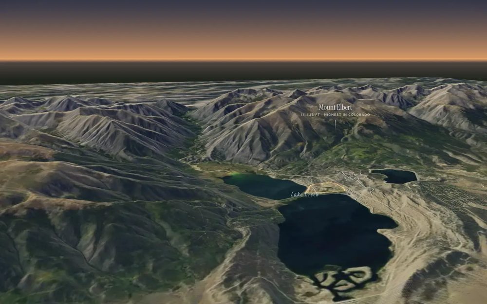
One real valley under Colorado's highest peak: the land, a sample lot plan with sun and lake view for each lot, and a lodge you could book.
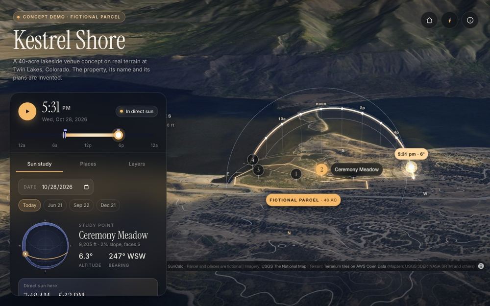
Drag the sun over real mountain terrain and see exactly when a lakeside lot gets direct light.
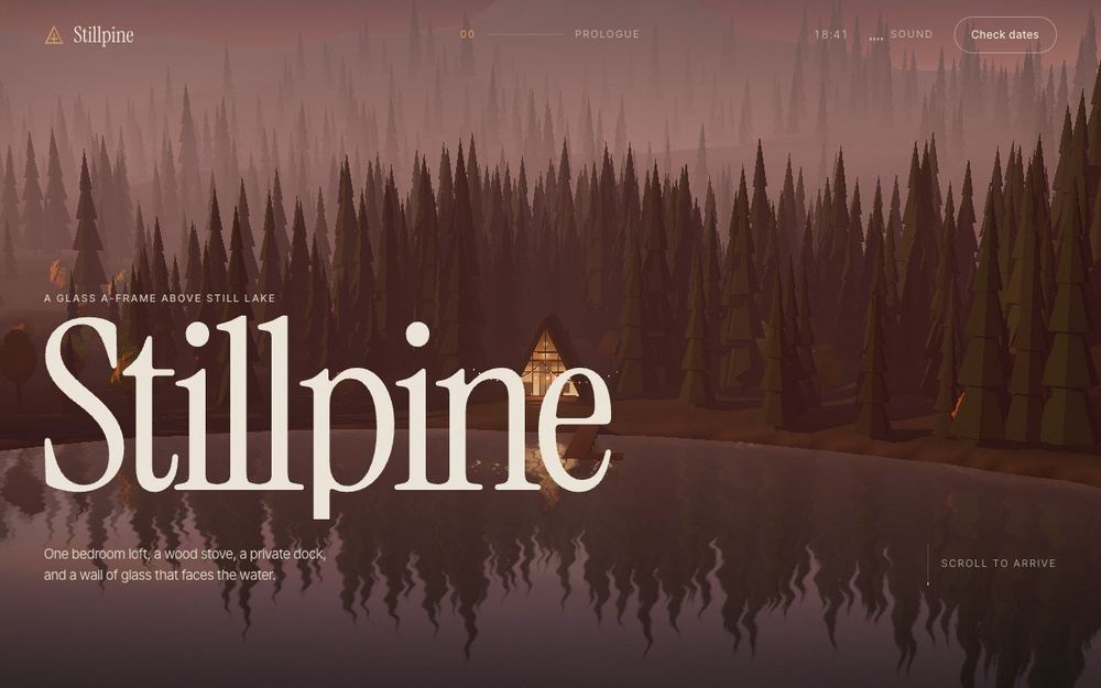
A website for a cabin retreat with a 3D valley you can move from dawn to night.
A venue website where couples explore the grounds in 3D: the ceremony spot, parking and golden hour.
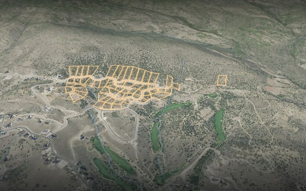
A website for a new community where buyers pick a lot on the 3D map and see its slope and sun.
04How it works
Your website, an address or a pin on a map, and what you want: the map, a website or both.
5 minutesA real, clickable draft on a private link. A 3D map takes about 72 hours; for a website we give you a date before we start.
On a private linkLike it? A 50% deposit starts the finished version, and the rest is due when it goes live. Don't like it? You owe nothing.
Your call05Pricing
For any place people buy, book or visit.
For your current website, a listing or a sale.
Your own land in 3D, for you or as a gift.
A good gift for a new landowner, or a closing gift from an agent to a buyer.
Try your land freePrices in US dollars. The monthly fee covers hosting and keeping the site or map running. Business projects: 50% to start, 50% at launch.
06Where the map data comes from
| Layer | Source |
|---|---|
| Ground shape, slope, contours | U.S. Geological Survey elevation data, the most detailed available for the area |
| Aerial photos | USGS The National Map and USDA aerial photos |
| Flood zone | FEMA flood maps, with the map's effective date |
| Soils | USDA soil survey |
| Streams and water | USGS stream maps, plus runoff worked out from the elevation |
| Property lines | County parcel records, checked against your own map |
| Sun | NOAA sun-position math, with shadows from the terrain |
07FAQ
Not always. If people care where things are on your property (lots, sites, the view, the lay of the land), a map helps them decide. If not, a website alone may be all you need. Not sure? Tell us about your place and we'll say which we'd pick.
Yes. The map goes into your current site with one line of code, the same way you'd add a video. You keep your site; we host the map.
Then you don't publish it, and you owe nothing. If you want it live, a 50% deposit starts the finished version and the rest is due when it goes live.
Your website or an address, and what you want on the page. Photos, prices and your logo help with a website. For a map, a property map or the spots you want marked.
Hosting and keeping your site or map online and working. There's no monthly fee on a personal map, a land tract page or an Auction Firm Pack.
Yes. Most people will see it on a phone, so we build for the phone first and test every page at phone size before you see it.
No. It's built from public data for planning, and every map says so on screen. Lines, acres and flood status can be off. A licensed surveyor and the county have the final word.
Anywhere in the US with public elevation data, which is almost everywhere. Where the data is coarse, we tell you before we build.
08About
Meridian Studio is run by Presley. We make websites and interactive 3D maps for places, using public data and modern web 3D. You deal with the person who builds your project, and every map layer is checked by hand against its source before you see it.
Why "Meridian"? A meridian is a north–south line on the map, the kind surveyors measure from. It felt right for a studio about places.
09Contact
A few lines is plenty. We'll reply with an idea, and we can build a working draft before you pay anything.
Or email [email protected]